|
SULFIDE RIDGE PROSPECT
LOCATION AND ACCESS
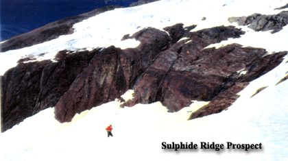
The prospect is located about 125 miles north of Anchorage and 13.5 miles west of Mile 290 on the Alaska Railroad at 65 degrees 05” North – 149 degrees 59” West in the Healy A-6 Map Quadrangle. It is partially exposed in a cirque at about 5,000 ft. of elevation at the headwaters of Partin Creek in the Alaska Range.
 GEOLOGY AND GROUND COVER GEOLOGY AND GROUND COVER
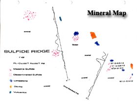
The property is underlain by an intercalated sequence of limestone and basalt on the flank of a dioritic mass. The limestone strikes NE and dip NW. Talus covers most of the cirque basin where the best ore exposures are located.
MINERALIZATION
Mineralization consists of massive and disseminated sulfides: pyrrhotite, pyrite, chalcopyrite and arsenopyrite with minor amounts of sphalerite, and galena. A fractured and well mineralized vein system can be traced for about 800’ and is covered at both ends. About 1,200’ along strike to north, a shallow trench reveals malachite stained gossan, but it did not reach ore.
The trend of mineralization can be traced along a north-south ridge, from a cirque on the west side to a stream bottom on the east side. Massive ore can be found in fracture fillings, long lenses, and pods. Disseminated sulfides and iron staining can be traced for the length of the ridge (Sulfide Ridge).
A high east-west ridge divides upper Partin Creek from the drainage of Shotgun Creek. Both streams are full of float and give good Au readings. The claim block and mineralization extends, well to the north, under ice and snow.
GEOPHYSICAL DATA
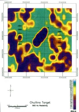
In 1997 the state of Alaska contracted a geophysical survey which included the Sulfide Ridge area. It shows a strong conductor based on the resistivity contour map.
The Crone Shoot-back EM lines over a small part of the cirque basin show good crossovers.
PREVIOUS WORK
Three shallow trenches, blasted into the fracture vein system, show: North to South over approximately 800’ the following: 12 feet 1.3% Cu, 0.31 opt Au and 1.0 opt Ag
11 feet 1.0% Cu, 0.11 opt Au and 0.42 opt Ag
10 feet 1.1% Cu, 0.14 opt Au and 1.23 opt Ag
The trench area is covered to the west by deep talus, but the west wall is well mineralized. The middle trench was dug into for 10 feet before it got too deep for hand work, but that work showed, east to west,
0.31% Cu, 0.11 opt Au and 0.14 opt Ag.
Random chip sampling shows extensive gold mineralization throughout the area.
Call Ron Anderson at 907-248-4302 for more information and phone number and address of owner.
|